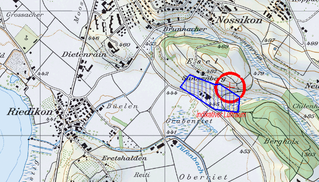
Achtung: die hier unten zugefügten Abschnitten von Landeskarten 1:50’000 oder 1:25’000 mit den angefärbten Flugräumen (BLAU) sind NICHT OFFIZIELL. Es sind nur Vorschlägen bzw. Erfahrungen aus dem Team F4N. Diese Visualiserungen ersetzten nicht die mündliche Koordination mit anderen Luftraumbenutzern (z.B. Paraglider). Jede/r RC Pilot haftet für sich selber. Das Team F4N übernimmt keine Verantwortung über die Flugtätigkeiten Dritter.
Note: the added sections of the maps 1:50’000 and 1:25’000 with the coloured flight spaces (BLUE) are NOT OFFICIAL. They are only suggestions or experiences based from the F4N team. The visualisations do not replace the verbal co-ordination with other airspace users (for example paragliders). Each RC pilot is liable for himself. The F4N team accepts no responsibility for the flight activities of third parties.
(Ground-) Maps: geodata © swisstopo
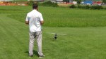
Locations we fly/flew (with PICTURES) > CLICK ON THE LOCATION NAME’S
BACHTEL-SCHUFELBERG, ZH-CH
BRISSAGO-RESCERASCA, TI-CH
CAVAL DROSSA (region MONTE BAR), TI-CH
MÖNCHALTORF, ZH-CH
PFANNENSTIEL, ZH-CH
GOSSAU (MG), ZH-CH
JEIZINEN, VS-CH
MAUR-LOOREN, ZH-CH
MONTE GENEROSO, TI-CH
MONTE TAMARO (Alpe Foppa), TI-CH
STABIO CAMPO DI VOLO (MG), TI-CH
UNTERE FESELALP, VS-CH
USTER SUNNENBERG, ZH-CH
VISPERTERMINEN, VS-CH
SANTA SEVERA, Rom-Italy (NEW!!!)
( Source Map: geodata © swisstopo)
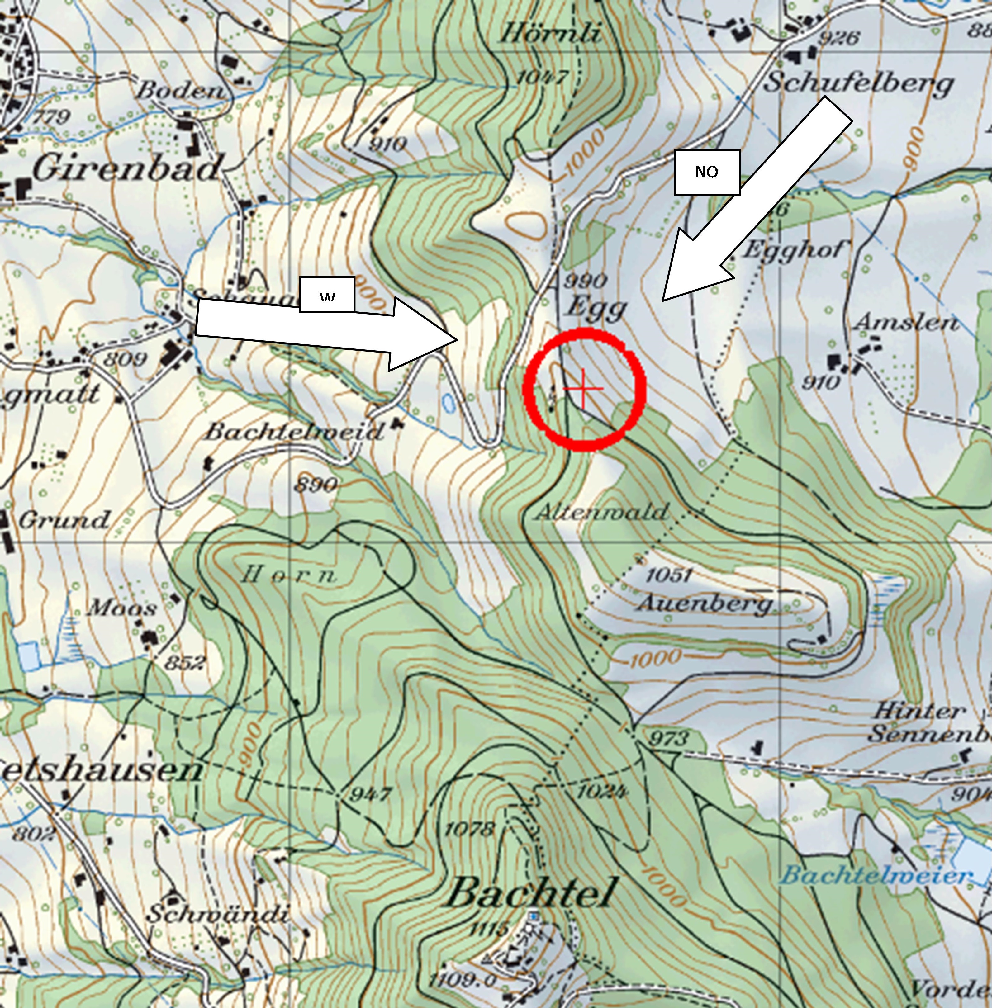
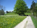
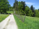
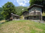
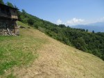
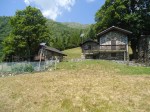
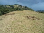
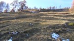
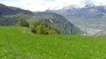
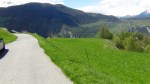
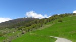
Bachtel-Schufelberg, ZH, Switzerland
| Coordinates (CH) |
709575 / 240300 |
| Elevation |
1005 m.a.s.l |
| Terrain |
little slope, grass |
| Optimal wind |
North-East or ev. West (double slope) |
| Max. wingspan |
max. 3 m |
| Take-off |
hand launch |
| Landing difficulty |
Beginner, Regular flyer, Advanced, Expert |
| Remark |
Only fly when grass is short, Sunday driving ban from Girenbad or Gibswil |
| Map |
 |
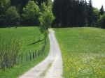
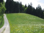
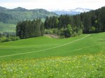
| Pictures |
|
Brissago-Rescerasca, TI, Switzerland
| Coordinates (CH) |
695599 / 107500 |
| Elevation |
1207 m.a.s.l |
| Terrain |
slope, grass |
| Optimal wind |
South or ev. North |
| Max. wingspan |
max. 3 m |
| Take-off |
hand launch |
| Landing difficulty |
Beginner, Regular flyer, Advanced, Expert |
| Remark |
Not reachable with car, private land, ask before fly, only fly when grass is short. 1h walk from Cortaccio (1000 m.a.s.l, here is the parking) |
| Map |
 |
| Pictures |
|
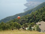
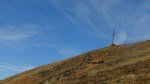
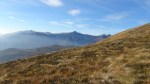
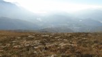
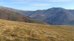
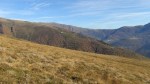
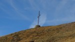
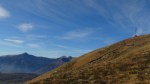
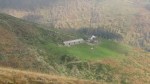
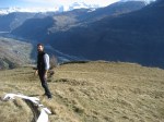
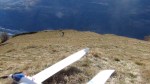
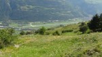
Caval Drossa “Crocione” (region Monte Bar), TI, Switzerland
| Coordinates (CH) |
719880 / 105640 |
| Elevation |
1420 m.a.s.l |
| Terrain |
big mountain slope, grass |
| Optimal wind |
South |
| Max. wingspan |
>3 m (but you have to carry the planes!) |
| Take-off |
hand launch |
| Landing difficulty |
Beginner, Regular flyer, Advanced, Expert |
| Remark |
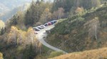
Not reachable with car. 45′ walk from Bidogno-Val Colla (1100 m.a.s.l, 720420/105395 here is the parking). In my opinion this location is much better as Monte Lema! Sometimes paraglider! Coordination with paraglider necessary, but there is enough place for all. The official start is about 50m unter the cross, please start/fly only from here GIUSTO (it is spoken with the farmer and the land owners!) |
| Map |
  |
| Pictures |
|
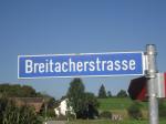
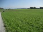
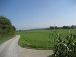
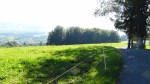
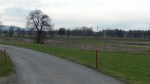
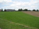
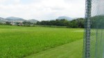
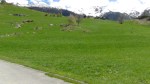
Mönchaltorf, ZH, Switzerland
| Coordinates (CH) |
697538 / 241500 |
| Elevation |
460 m.a.s.l |
| Terrain |
Open and flat farmland |
| Optimal wind |
North, South, East, West |
| Max. wingspan |
>3 m |
| Take-off |
Electric motor/hand launch or bungee for no motor |
| Landing difficulty |
Beginner, Regular flyer, Advanced, Expert |
| Remark |
Only fly when grass is short |
| Map |
 |
| Pictures |
|
Pfannenstiel-Hochwacht, ZH, Switzerland
| Coordinates (CH) |
693538 / 238467 |
| Elevation |
660 m.a.s.l |
| Terrain |
Hill slope |
| Optimal wind |
Only North East |
| Max. wingspan |
max. 3m |
| Take-off |
Electric motor/hand launch/no motor lunch |
| Landing difficulty |
Beginner, Regular flyer, Advanced, Expert |
| Remark |
Only fly when grass is short and no cows. Be careful about hikers. |
| Map |
 |
| Pictures |
|
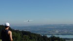
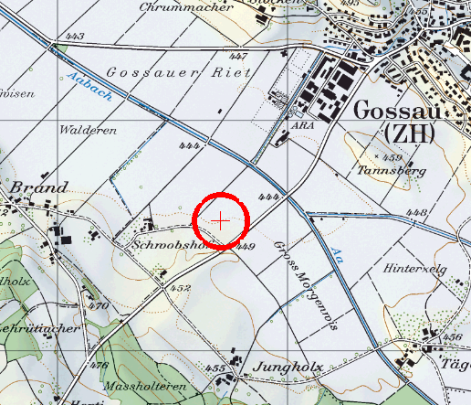
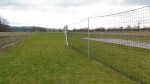
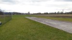
GOSSAU (MG), ZH, Switzerland
| Coordinates (CH) |
698700 / 239600 |
| Elevation |
450 m.a.s.l |
| Terrain |
Open and flat farmland, “carpet runway” |
| Optimal wind |
North, South, East, West |
| Max. wingspan |
– |
| Take-off |
All typ of planes: electric and nitro/motor, planes and helicopter |
| Landing difficulty |
Beginner, Regular flyer, Advanced, Expert |
| Remark |
Members only of www.mggossau.ch, no official parking |
| Map |
 |
| Pictures |
|
Jeizinen, VS, Switzerland
| Coordinates (CH) |
622385 / 130835 |
| Elevation |
1560 m.a.s.l |
| Terrain |
Mountain, big slope |
| Optimal wind |
East or West |
| Max. wingspan |
max. 3m (more ist possible but diffcult to land – flaps!!) |
| Take-off |
Electric motor/hand launch/no motor lunch |
| Landing difficulty |
Beginner, Regular flyer, Advanced, Expert |
| Remark |
Best wind between 09:00 and 12:00 a.m.After 12:00 only with eavy gliders >1.5-2kg |
| Map |
 |
| Pictures |
|
Maur-Looren, ZH, Switzerland
| Coordinates (CH) |
691835 / 243696 |
| Elevation |
540 m.a.s.l |
| Terrain |
Hill, small slope |
| Optimal wind |
North East |
| Max. wingspan |
max. 3m |
| Take-off |
Electric motor/hand launch |
| Landing difficulty |
Beginner, Regular flyer, Advanced, Expert |
| Remark |
Not fly over the sport place and not over the school |
| Map |
 |
| Pictures |
|
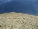
Monte Generoso, TI, Switzerland
| Coordinates (CH) |
723029 / 087590 |
| Elevation |
1600 m.a.s.l |
| Terrain |
Mountain, big slope |
| Optimal wind |
South |
| Max. wingspan |
>3m |
| Take-off |
Electric motor/hand launch |
| Landing difficulty |
Beginner, Regular flyer, Advanced, Expert |
| Remark |
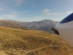
Paraglider and from parking “Bellavista” about 1.5h march/walk (or just to the top with train from “Capolago” – but ticket costs 35.- per person – it is in my opinion too expensive) |
| Map |
 |
| Pictures |
|
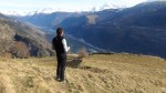
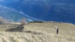
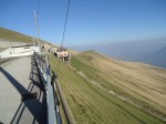
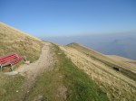
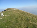
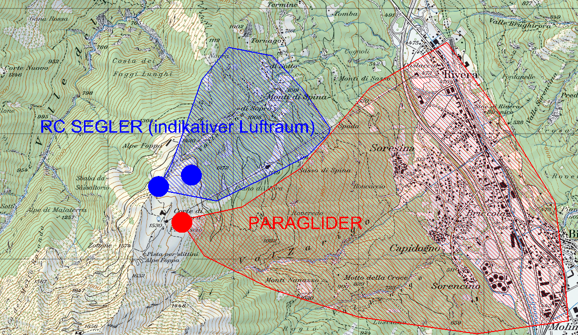
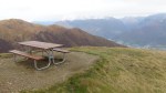
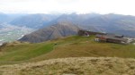
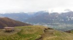
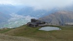
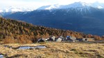
Monte Tamaro (Alpe Foppa), TI, Switzerland
| Coordinates (CH) |
712345 / 108500 |
| Elevation |
1530 m.a.s.l |
| Terrain |
Mountain, big slope |
| Optimal wind |
North |
| Max. wingspan |
>3m |
| Take-off |
hand launch |
| Landing difficulty |
Beginner, Regular flyer, Advanced, Expert |
| Remark |
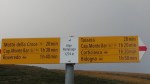
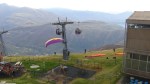
Es lohnt sich! Koordination mit den zahlreichen Paraglidern sehr wichtig (meine zugefügte Karte mit der Luftraumkoordination IST NICHT OFFIZIELL!! Es handelt sich nur um einen möglichen Überblick). Saison: Restaurant und Gondelbahn von März bis November. Gondelbahn aus Rivera TI, 20 CFH/Person. Zu Fuss Rivera-Alpe Foppa ca. 3h, sehr steil. Weitere Informationen: http://www.montetamaro.ch |
| Map |
 |
| Pictures |
|
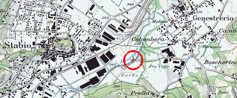
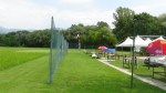
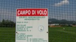
Stabio, Campo di Volo (MG), TI, Switzerland
| Coordinates (CH) |
717510 / 078676 |
| Elevation |
380 m.a.s.l |
| Terrain |
flat, gras runway (180m), forest (7-10m Plants) on border |
| Optimal wind |
South or thermic (for glider) |
| Max. wingspan |
max. 3,5-4m (glider) |
| Take-off |
All typ of planes: electric and nitro/motor, planes and helicopter |
| Landing difficulty |
Beginner, Regular flyer, Advanced, Expert |
| Remark |
Members only of www.gam2000.ch |
| Map |
 |
| Pictures |
|
Untere Feselalp, VS, Switzerland
| Coordinates (CH) |
621970 / 132240 |
| Elevation |
1950 m.a.s.l |
| Terrain |
Mountain with stones, less gras, slope |
| Optimal wind |
East or West |
| Max. wingspan |
max. 2,5 ev. 3m |
| Take-off |
Electric motor/hand launch |
| Landing difficulty |
Beginner, Regular flyer, Advanced, Expert |
| Remark |
Sommer: cows |
| Map |
 |
| Pictures |
|
Uster Sunnenberg, ZH, Switzerland
| Coordinates (CH) |
697520 / 243370 |
| Elevation |
480 m.a.s.l |
| Terrain |
slope, gras |
| Optimal wind |
West |
| Max. wingspan |
max. 3m, better wing and about 2m glider |
| Take-off |
hand launch |
| Landing difficulty |
Beginner, Regular flyer, Advanced, Expert |
| Remark |
Slope: good for slope planes and wings but there are also a lot of termal conditions and enough place for landing also with max. 3m gliders. 5′ to walk, no car allowed. |
| Map |
 |
| Pictures |
|
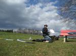
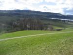
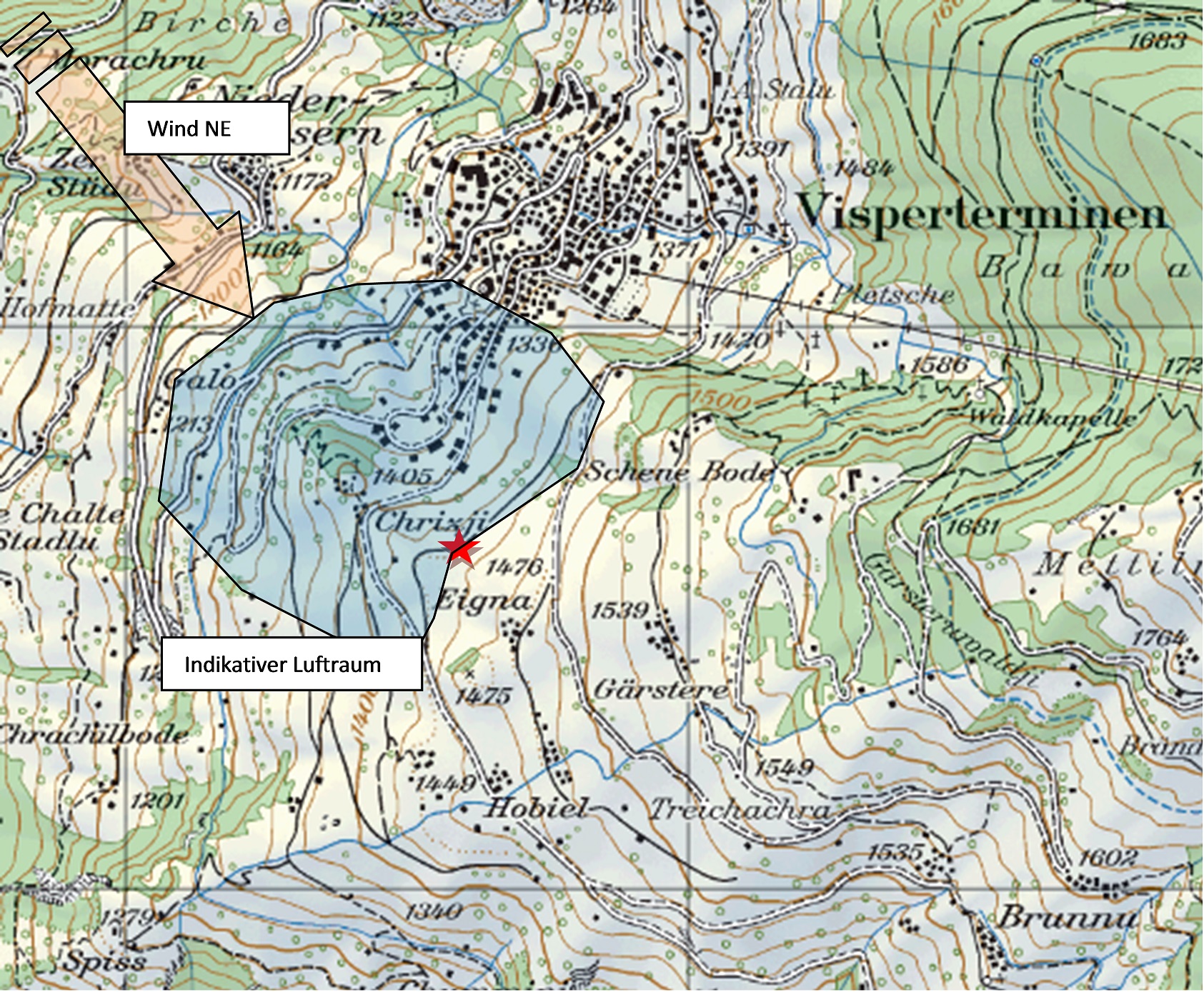
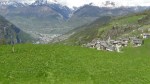
Visperterminen, VS, Switzerland
| Coordinates (CH) |
635550 / 122580 |
| Elevation |
1430 m.a.s.l |
| Terrain |
slope, gras |
| Optimal wind |
West / North West |
| Max. wingspan |
max. 3-4m |
| Take-off |
hand launch/electric motor/bungee |
| Landing difficulty |
Beginner, Regular flyer, Advanced, Expert |
| Remark |
Huge and awesome slope! Only fly when grass is short. With car 5 CHF drive ticket. Other accurate informations on http://www.gebidempass.ch/ |
| Map |
 |
| Pictures |
|
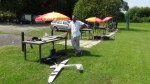
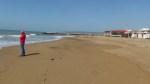
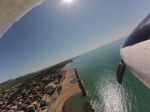
Santa Severa, Rom-Lazio, Italy (new!!)
| Region |
Lazio, 1h with the car from Rom, direction N (not far away from Civitavecchia or Grosseto)
Coordinates: 42.02319 / 11.94423 |
| Elevation |
0.0 m.a.s.l |
| Terrain |
beach, sand |
| Optimal wind |
West |
| Max. wingspan |
max. 3m |
| Take-off |
hand launch/electric motor |
| Landing difficulty |
Beginner, Regular flyer, Advanced, Expert |
| Remark |
Fly only between October and April, there aren’t in this period beach umbrellas and few people. |
| Map |
 |
| Pictures |
|


Pingback: Winter flying in the Swiss Alps | Flying4Nature.com
Pingback: Maiden flight of BETA | Flying4Nature.com (F4N)
Pingback: Fly session 09.-11.05.2013, Wallis | Flying4Nature.com (F4N)
Very good description of your favourite spots! Did you put them on to http://www.slople.com?
Hallo Christophe! Ja, die meistens sind auch in Slople eingepflegt. Gruss aus ZH.
Pingback: Soaring in Ticino | Flying4Nature.com (F4N)
Pingback: Black and White, Taser E PCM | Flying4Nature.com (F4N)